From its beginnings in 1921 the Department was charged with the responsibility for providing landing grounds along the major air routes. Over the years, the Department established, owned and maintained nearly every licenced airport and aerodrome in the country until, in the 1980s, the Aerodrome Local Ownership Plan and other airport disposal schemes saw the Department divest itself of the ownership of almost all aerodromes and airports.
This page provides links to information about the Department's involvement with airports and aerodromes.
Consult a list of Unit and equipment acronyms used on this site
Read about The
Early Days of Civil Aerodromes
Photos of early Aerodrome Site Selection - 1921
See a strip
map of the Melbourne-Adelaide air route, including aerodrome diagrams
- 1939
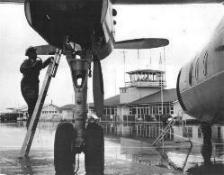
NSW Airports Engineering staff - 1950
< Click on the image at left to download and read an article, Problems About Airports,by Dr Bill Bradfield from Wing Tips, a Qantas staff magazine, Vol 7 No 2, c.1968. In the article Dr Bradfield discusses some of the challenges facing Australia in airport development at that time.
(3.7 MB .pdf file)
Capital City Aerodromes
Perth/Maylands
- photo of the WAA hangar flooded - 1926
- WAA's, later ANA's, historic Hangar No 1 - 1931 & 1976
- aerial photos from just before the aerodrome closed - 1961
Perth/Guildford
Sydney/Mascot (Kingsford Smith)
- Mascot Aerodrome as it was Experienced by Neville Watson
- aerial photo - c.1930
- aerial view - June 1958
- major works including runway extension and construction of a new International Terminal - 1967-74
Sydney/Bankstown
- aerial photo - c.1970s
Adelaide/Parafield
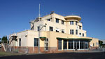
- Operations-Administration Building & Control Tower - 1940s, 1960s, 2008
- superb aerial photos - 1948 & 1965
Adelaide/West Beach
- photos of the Passenger Terminal and Control Tower just after opening - 1957
- photo of the old passenger terminal building and Control Tower, c. late 1960s
- aerial photos - mid-1980s
- passenger terminal just before demolition - 2008
Hobart/Cambridge
- photos
of the aerodrome - 1934, 1942
- runway layout - 1955
- aerial photo and layout - 2011
- surviving, historic former Control Building - 2011
Melbourne/Essendon
- the development of Essendon Airport
- the 'Government Hangar' c.1930s
- the ATC complex - c. early 1950s
- the special International Terminal for the 1956 Melbourne Olympic Games
- charts showing the airport layout in 1960 & 1968
- aerial photos - c.1930, 1963, 2004, 2007
- aerial view of the DCA apron and hangars - 1973
- then & now panorama views
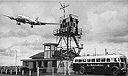
Melbourne (Tullamarine) Airport
- Aerial photo mosaic showing Essendon, and Tullamarine under construction - 1967
- RAAF
aircraft at Melbourne/Tullamarine - 1971

- runway widening - 2005
Melbourne/Moorabbin
< Download a short history of Moorabbin Airport & Control Tower by clicking on the icon at left. (260 KB .pdf file)
Brisbane/Archerfield
- aerial photos - 1931
- 'then & now' - c. mid-1930s/2006
- aerial
photos - 1965; Pages 1 & 2
- photo
of the Ops-Admin Building
c.late 1960s
- views of the Control Tower cab - 1974
- aerodrome diagram - 1974
- 'then & now' - overviews from 1965 & 2006
- historic buildings - 2006
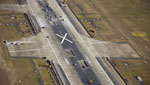
Brisbane Airport
- aerial photos - 2005
Darwin/Parap
- composite photo & aerodrome diagram - late 1930s
Regional Aerodromes
Alice Springs
- Control Tower - c.1970s-2007
Ceduna
- photos of Ceduna aerodrome buildings in the early 1950s with a description from Macarthur Job
- aerial colour photo - c.1955
Charleville
- aerial photos - 2001
Cloncurry
- passenger terminal c.early 1960s
- Aeradio building & historic Qantas hangar - 1940
- the same building as the passenger terminal - 1974
- new passenger terminal - 2001
Cocos Island
various views - 1955-57
Cootamundra
- photo of the aerodrome c.1960s
Devonport
- Control Tower and passenger terminal - 1965
Dubbo
- aerial photo - 2007
Fitzroy Crossing
- photos and diagram - 1972
Flinders Island
- aerial photos - 2004
Forrest
- photos of showing the historic hangar and hostel - 1972 & 2009
Karratha
- overviews - mid-1980s
Longreach
- photos of the first runway strips laid anywhere in Australia- 1925
Mackay
- Control Tower and passenger terminal - 1960s
Mangalore
Meekatharra
- The Day Qantas Came to Meekatharra - 1975
Port Lincoln
- aerodrome layout - 1968
- passenger terminal - c. late 1960s
Quirindi
- photos from the opening of the aerodrome -1957
Rockhampton
- panorama photo from -1968
Tamworth
- photos of the old Tower and passenger terminal - 1968-1990s
Wynyard
- the unique railway crossing - 1971
Karumba
- Flying Boat Base - 1938
Rose Bay
- opening - Aug 1938
- more photos - 1939
- aerial photos - c.1942-43, c.1950
- DCA Control Launch C.A.15 - 1969
Drawing
of Aerodrome Ground Markings
-1928
The Signal Square
The more modern Signal Area

Photo of a typical Rotating Aerodrome
Beacon
Photo of a typical Illuminated Wind Indicator
The Calvert Cross Bar Approach Lighting System
Airport power supplies & downloadable A Brief History of Power Supply Systems for Civil Aviation Facilities in Australia1928-2018
Spraying runway markings - 1959
DCA Control Launch C.A.15 - 1969
Pavement Classification Numbers - introduction of the ACN-PCN system - 1982
Aerial photo showing typical Precision Approach Runway markings - Brisbane 2007
Photo of the ubiquitous Airport Safety Officer and vehicle - 1984
Photos of and information about a Linesman at work splicing a cable - 2007
Read about the Department's Bird Hazard Identification Unit
Back to the main History Menu
If this page does not display menu bars at top and left, click here